Washington State- Mt. Rainier, Seattle to Home (Conclusion)! August 4th- August 23rd, 2018
I drove the long way from Yakima to Packwood. A straight shot would be just about 2 hours, but I’m not done road tripping yet, so I decided to make a loop and drive the Columbia River Gorge through Oregon and then back up towards Packwood. I have wanted to see Multnomah Falls for years, and now was my chance to do it. The drive was wonderful, but I thought my side trip to the falls would be a quick. It wasn’t. Turns out that the area around the falls has suffered from damage from a fire just last year. This also closed the upper portion of the falls hike, so one can only hike to the iconic white bridge and no further. When I arrived, the parking lot was closed. I thought the whole area was closed off, but the lot was just full. I took an exit to do a turn around to check things out, when I stumbled into a park area that provided shuttle service to the falls. Sounds like they close the parking lot once full and don’t reopen until 10% of the lot is available. Since I drove all this way, I did wait and take the shuttle service to the falls. Once there, with the upper trail closed, it was a quick visit, before getting the shuttle back to my parked car. Was it worth it, absolutely! Multnomah Falls is the picture on the front of my atlas.
Mount St. Helens was also on my way, so I stopped at the visitors center and learned I needed to go an hour further (away from my destination) to get a good vantage point, to the Johnson Ridge Observatory. With a two-hour drive to my destination, I knew I would not come back this way, so I went for it. The drive was awesome and I don’t remember the mountain looking as impressive as it did. I was able to watch the gases leaving the caldron of the mountain. I verified this scene with my binoculars, and sure enough, it was smoking. I hiked a little ways and was surprised by all the flowers in this desolate area.


I arrived to my destination feeling a little dazed from my long drive. Luckily, I had prearranged a motel room for the night. I ordered a large pizza and scarfed it down, not all of it! I had to carb load for my run to Packwood Lake the next day.


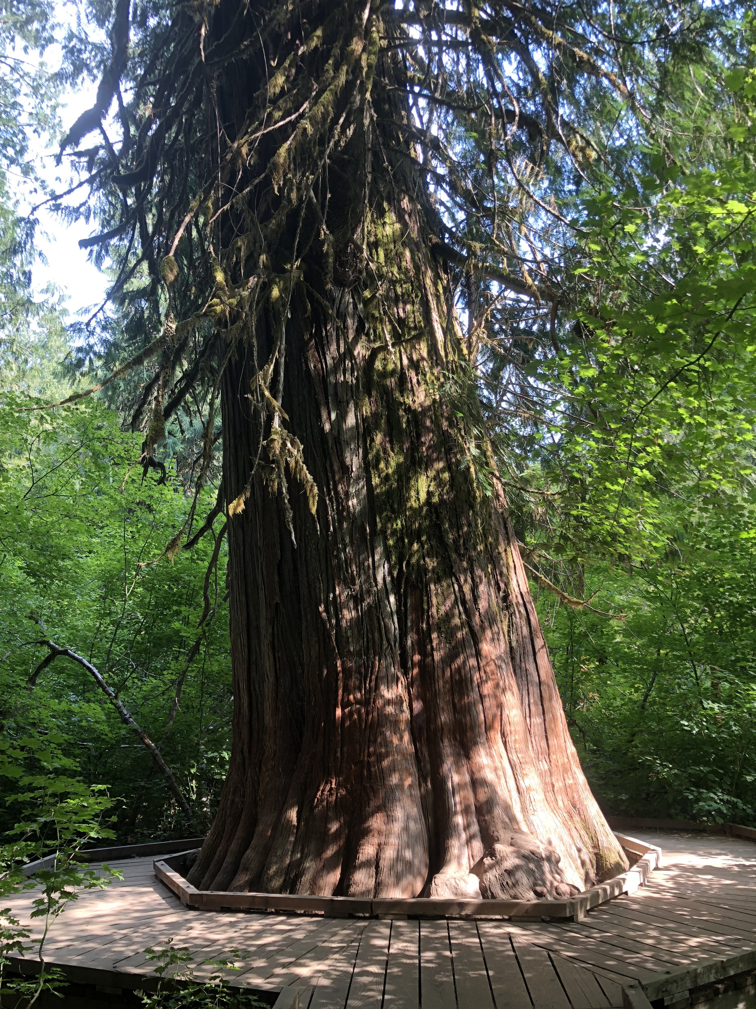
My motel was a mere 7 miles from Mt. Rainier, my next destination. With a little time left after the run though, I hiked the easy trail Groove of the Patriarchs. This is a must do when visiting the area. The majestic trees are over 1000 years old.


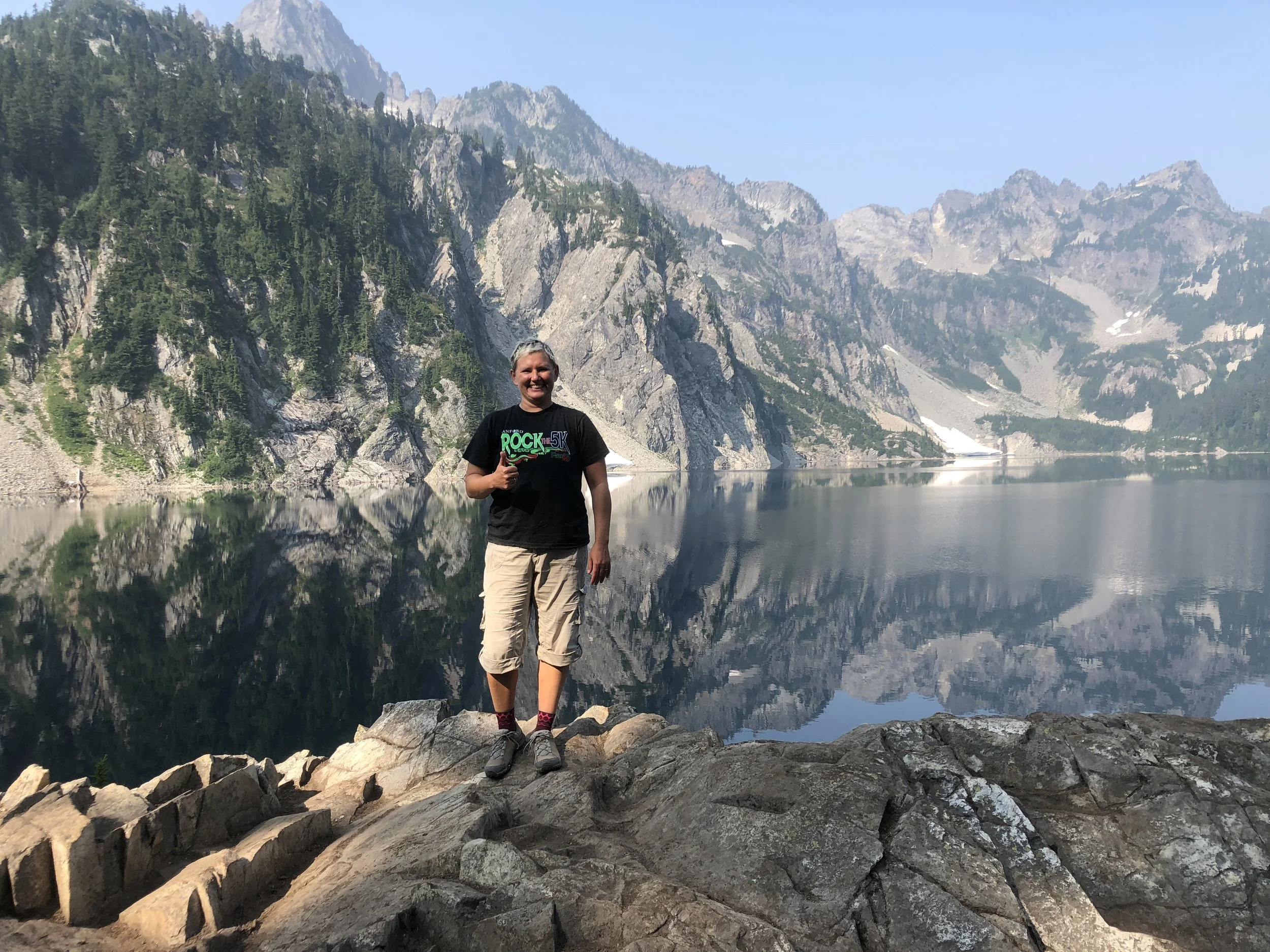
Now it’s time to hit the park and set up the tent yet again. My first stop was to Paradise. I arrived in the middle of the afternoon and the place was bustling, the parking lot full, although a few spots remain available on the side road. After picking the park ranger’s brain, I hiked the Skyline trail. The lower portion of the trail is paved for quite some time; I’d imagine to protect the delicate meadows that have been stomped upon for years. Hiking this area reminded me of a sign I saw at Mt. St. Helen’s, “flowers grow by the inch and die by the foot”. The pavement and views made the trail deceiving. It is listed as strenuous in my National Park book with a 1700-foot elevation gain. I only brought a banana as I thought I would be doing “flower trails”, but I had plenty of water. It is also the beginning of the trail to Mt. Rainier base camp, Camp Muir. I could see the buildings on the snowfield with my binoculars, a long and arduous 2-mile slough through snow with ~2800 foot elevation gain from where I was standing. Despite that, there was a trail and it looked doable for a day hike. I thought about it, but that would not have been a good idea underprepared nutritionally and gear wise. I thought about Candace, she worries that I’ll fall into a crevasse somewhere. I told her I was not hiking on any crevasses, and I should keep my word! I also spoke with a climber who was headed down. He had planned to summit, but he said he was toast by the time he arrived to Camp Muir “I wasn’t feeling it, I’m going to Portland instead”. I love this place.


Over 15 years ago, I hiked the Wonderland trail. This trail is 93 plus miles encircling the base of the mountain. I remembered this crazy scary suspension bridge, and wanted to go back and check it out. The mountain has changed since that time; some of the roads are closed due to constant flooding. I did learn I could get to the bridge and also pass a popular flower field called Indian Henry’s hunting ground. The map, or rather guide, showed the bridge at 7.4 miles (one way). Indian Henry’s was actually 7 miles in, and I expected just 0.4 more, but thought it was a rather long 0.4! There was a patrol ranger station at Indian Henry’s. I thought it was open to the public, so I walked in, catching the ranger lying on his cot. “I just realized I shouldn’t have walked in here”, I said. He was cool, “no worries”. He told me the bridge was actually 9 miles in! At that point, I had 7 miles to go to get out. I had already hiked 11, ouch. No crevasses, but a long, hard day. The hardest, my feet were so sore, I only had the energy to clean up and eat leftover pizza. I also got out right before dark, as it gets dark here by 8:30-9:00pm with the tall trees.


I’ve had a couple firsts camping in Rainier. First time using my bathing wipes that I’ve had the whole time, needing the refresher after that long hike. First mosquito bites on the tip of my earlobe and forehead. First time eating chicken on a stick. First time taking a nap! I moved camps and traveled to the Northeast side of the park, White River.


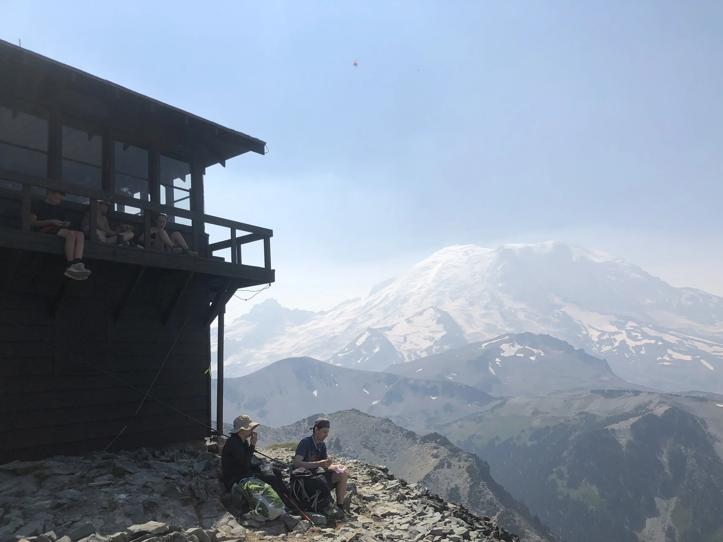
Needing to leave a bit early with first come, first serve sites; I arrived before 10am with plenty of sites to choose from. I set up camp and headed over to Sunrise for a trail run. I chose the Mt. Fremont trail, a fire lookout. It was awesome! The views of Mt. Rainier were obscured by haze, but beautiful nonetheless.


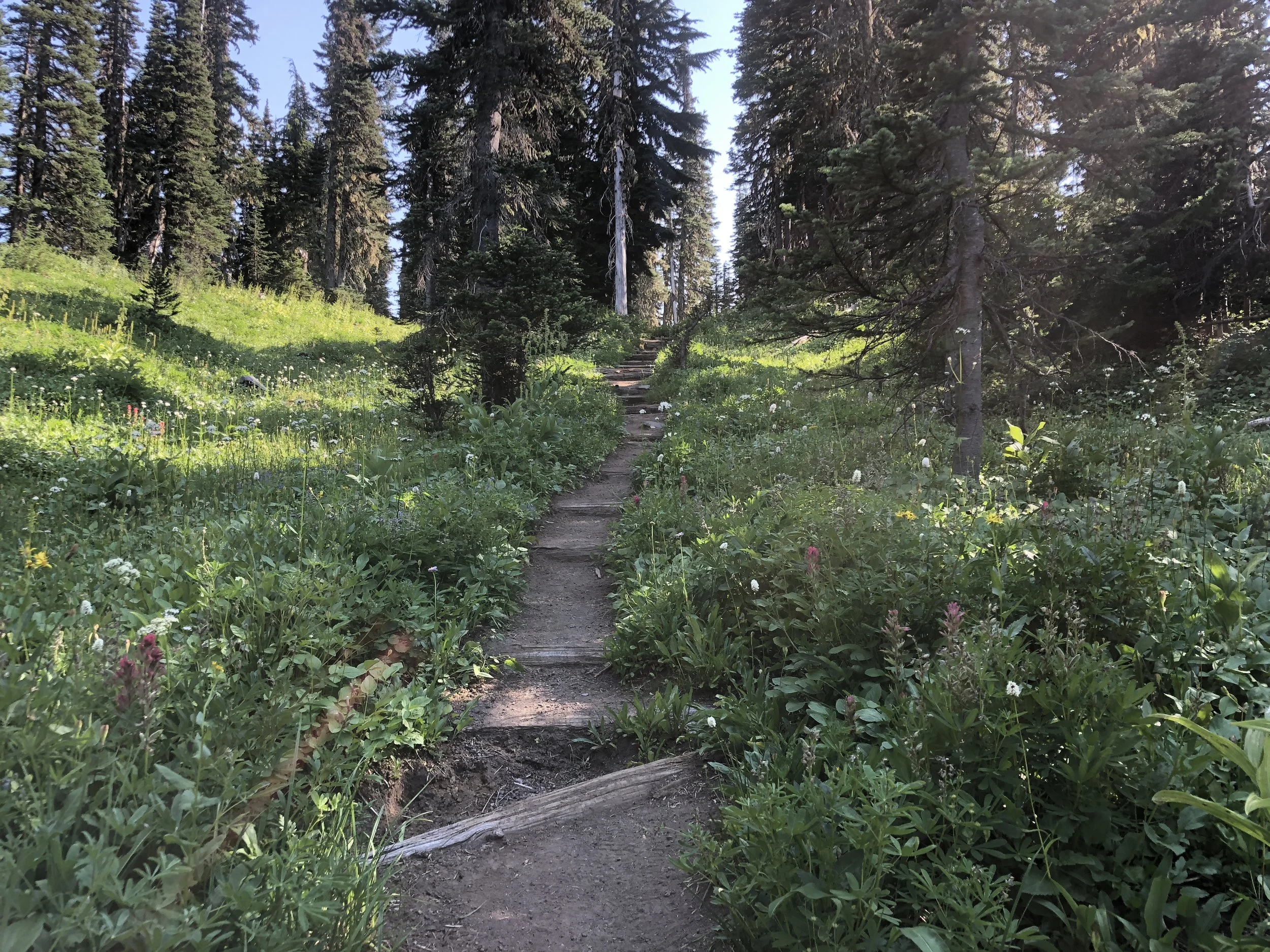
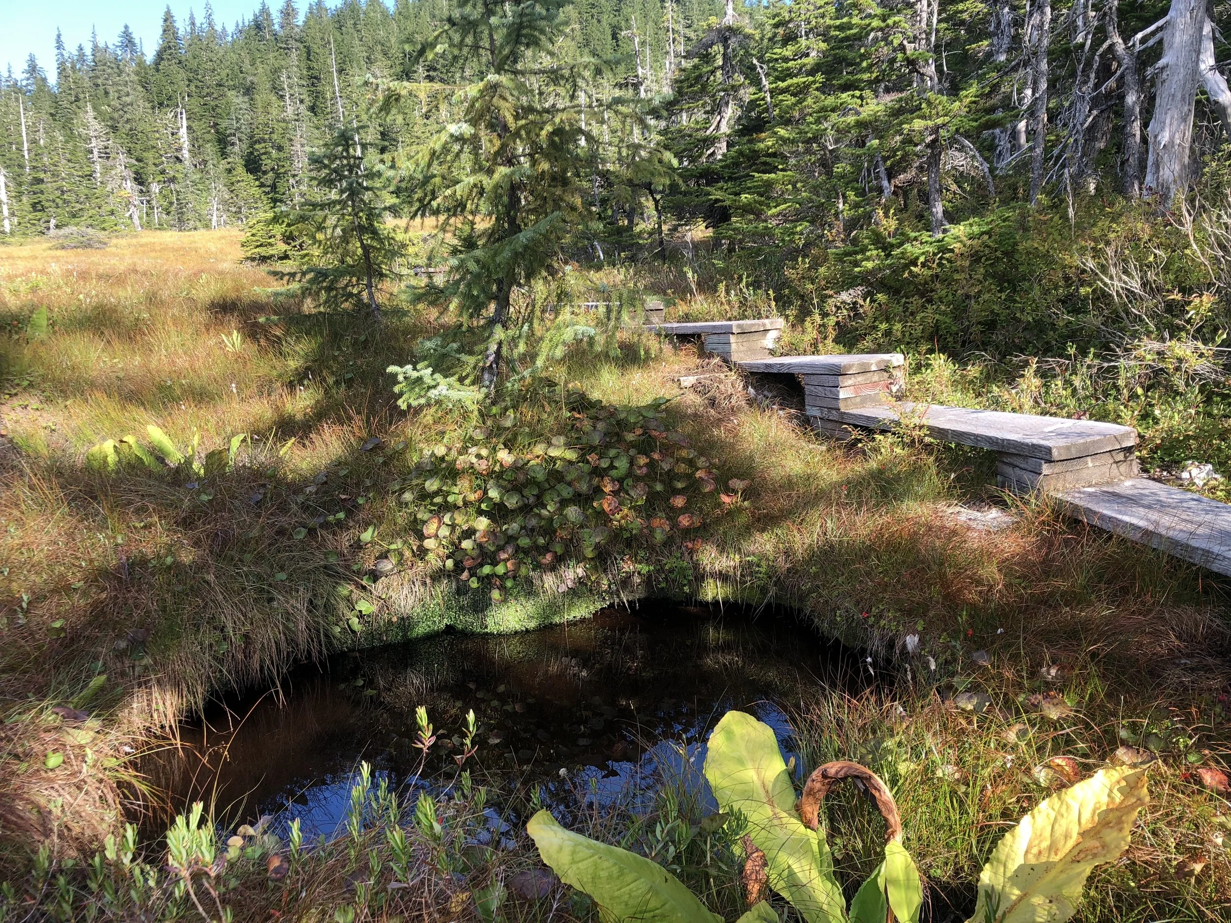
Studying the map of the Sunrise area, I found a 10-mile loop that I could accomplish right from the campground! These are my favorite hikes! Don’t have to get up too early to drive to a trailhead, and you can roll right back into camp when you’re done. It was a long day, nonetheless. The loop included a hike I read about, Burroughs Mountain, that I planned on doing my last day, which increased the appeal. When I went over my plan with the ranger, she said that I would see all the landscapes of Mt. Rainier in this relatively short loop. The trail gained and lost about 3200 feet in elevation, quickly going up from the campground through old growth forest, to the sunrise area, a 2ish mile hike on the Wonderland trail. The drive from the campground to the same area is 10 miles! Next came the Burroughs Mt section, over an old lava field with excellent views of Mt. Rainier and delicate plant life. The mountain so close it seems you could reach out and touch it, even through all the haze.


Next came the descent, and while the trail was always well marked, I passed one area that wasn’t and was praying that I made the right turn. Deep inside knowing I did, but thinking doubling back would be the worst that could happen. And it would have been, losing all of the elevation in about 3 miles, it would be a tough hike back up. I was the only hiker on this section, and the flower fields were vast and unspoiled by feet.


Alas, no wrong turns taken; I made it to the section of the trail paralleling the river. I took a short, 1-mile side trip to the Emmons Glacier Moraine trail, a worthwhile side trip with views of the river running from the depths of the glacier. Shortly thereafter, I rolled into camp with enough time to set up the hammock briefly to read and rest my feet before cooking my last camp dinner in the lower 48.

I realized that I didn’t do enough relaxing on my journey, opting for adventure instead. So instead of hiking on my last day, which I planned, I started a fire and read until checkout.
I made my way to Seattle, where I was staying with my childhood friend, Danielle and her husband, Eric and two kids, Dylan and Brody. Danielle and I grew up together and we have known each other for 34 years. I realized recently that Danielle has been one of the most influential people of my life. We met at the same age her oldest, Dylan, is now, 9. I can’t remember the last time I saw them, but it was like no time had passed, except for the fact that the kids were growing up! We spent a leisurely weekend together, tide pooling in Edmonds before catching the ferry to go to a candy store, a highlight not only for the kids, but for me as well.


It was also great to have some home cooked meals! Eric treating us to steak the night I arrived. After the weekend, the adults went to work and the kids to summer camp. I made my way into Seattle to be a tourist and reminisce, since I lived in the city from 1999-2005. There have been many changes since I’ve left! One place that didn’t change was Rudy’s, my old “barber” shop where I got my hair cut. The prices changed though, from $20 to $36, which is still a killer deal and I got a great cut.


I also got to visit with my old friend Diana, who I haven’t seen in about 10 years! She’s another friend, that when you reconnect, it’s like no time has passed. And my friend Geysa, who just left Anchorage 2 years ago to make a life in Seattle. Geysa lives near my old stomping ground, and going out to dinner with her and her girlfriend, gave me a taste of the Seattle I knew and loved back in the day.
But what I loved about living there was the hiking, which is still great! Danielle and I hiked north nearer to her home and we struck out with the hike we chose, Lake Serene, it was closed due to heavy equipment on the trail. We instead found a hike on the PCT called Hope and Mig Lake. It was a nice forest hike to 2 alpine lakes.

Danielle was quite the hostess while I was there. Her cousin, Brittney and her boyfriend Mason also came up for a visit. We all got up at 0500 and hit the road by 0615 to avoid rush hour to hike one of the classics, Snow Lake. This is one of my favorite all time hikes! Seattle and surrounding area was filled with smoke from all the wildfires around, but I figured we would be able to see the lake. And we did, it was just as I remember. The highlight of the hike though, was Mason diving head first into the cold, clear waters! Now that, I hadn’t seen before.


I also had to check out the town of North Bend while down there, the town where Twin Peaks was filmed. For the fans, here the shot you see in the opening credits.

Friday came around and it was time for me to drive back to Bellingham to board the Alaska Marine Highway for Ketchikan! Of course, I had to stop at a bakery in Bellingham to get some bread for my journey. Not wanting to spend money on meals on the boat, I got creative. Besides PB&J, I had a can of tuna and soup. I could use the condiments, like mayonnaise without paying. I asked the cashier if I could buy a slice of cheese. He gave me 7 slices for free! I had one cheesy sandwich!
I got off the ferry for an overnight stay. Ketchikan is Alaska’s 4th largest city, population about 8200. I checked out the campgrounds in the area and found a prime spot next to a river, with a trailhead right in the camp! I had spotted a bear on the drive to camp, so I wore my jingle bells on the run. Being a good Alaskan with an excess of bear spray at home, I gave Danielle my spray since my journey was finishing up, but quickly realizing, it wasn’t over yet!

I had done my research beforehand and strung together several trails that intersect, to form a long trail run. I started from the campground on the Ward Creek trail, which was a bonus trail, as I had planned to camp elsewhere. This connected to the Ward lake trail, which connected to the Perseverance Lake trail. This part of the run was quite difficult, with many steps leading to a large lake. I happened upon an elderly man, sitting on the trails end, munching on mini candy bars and soda. When he asked me if I ran up there, he exclaimed in a gruff voice “You gotta be shitting me!” He was 71, so doing quite well himself! Not getting enough of the wooden planks and stairs over the muskeg yet, this trail had split again before a slight decent to the lake. I read that this trail leads to a large meadow, but I didn’t make it there. A large downed tree was blocking the wooden stair planks, and I didn’t have the energy to climb over and I was satisfied, so I turned back. I was pretty tired when I started this run and I wondered why, thinking maybe I ate too much bread the past 2 days. I didn’t realize the elevation until I ran down. My knees were upset with me after that one.


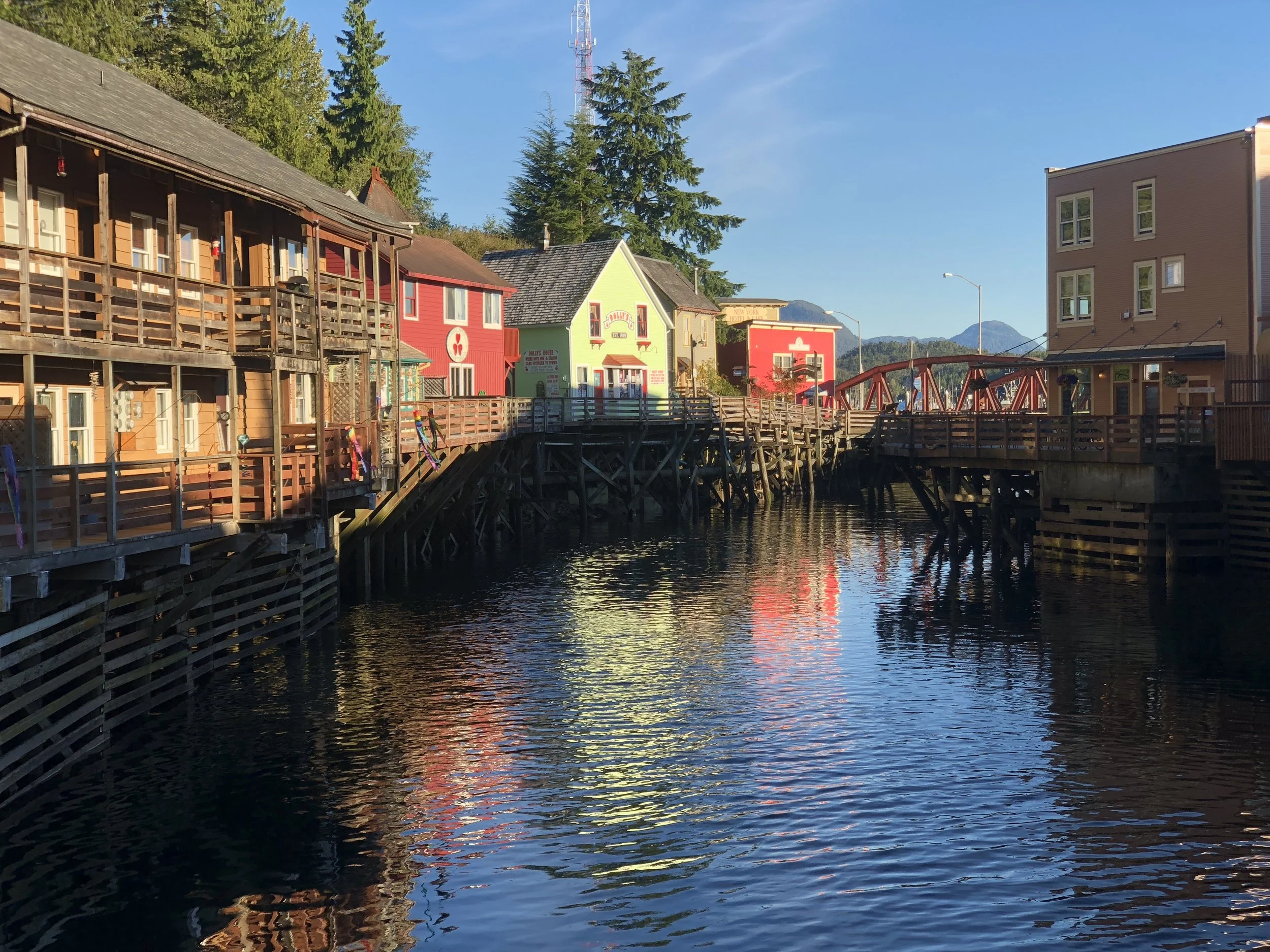
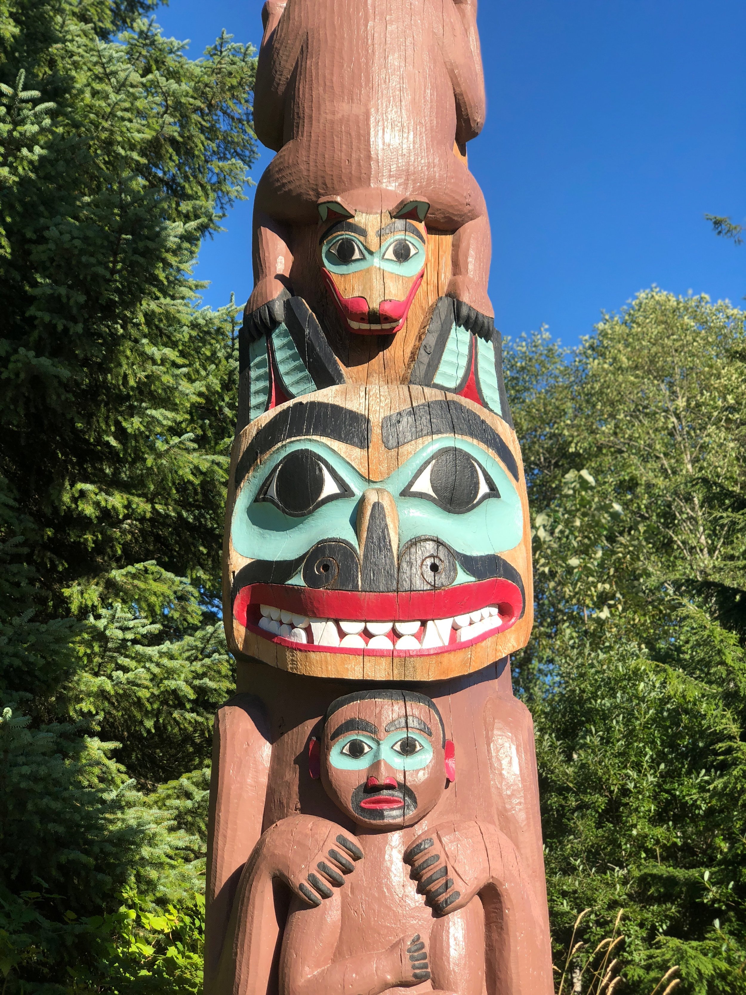
After a quick camp lunch, I checked out the towns two totem pole parks, Totem Bight and Saxman parks. Then, I headed to town. I arrived in-between cruise ships and Creek Street was quiet. When I visited 2 months ago, the street was buzzing with tourists. Now the locals were out, grilling on their decks, and people were leaning on the banisters, staring into the water and beholding the silence.


I awoke early the next day to build a morning fire while breaking down camp. I was to be back on the Ferry that morning. I didn’t fill my cooler since I had one day of camping left, so I make M&M pancakes for breakfast, improvising with the last of my dry goods.
I got on the ferry on a nice sunny AK day. I set up my nest in the solarium, this boat having the solarium along the side of the ship, completely inside. I shared the space with 2 men, one used the spot for sleeping only, and the other hung out there like myself. We shared nods for about 12 hours, until I commented on large waves. His name was Donny, an artist from Ketchikan. Once we started talking, the floodgates opened, and it was more challenging to get back to my fantastic book.
Donny got off in Juneau, and was quickly replaced by a German; white haired, smiley chap who had been camping for 10 days. He hung up his tent on the pipes to dry, and draped his undergarments from his chair, to do the same. He hand washed his clothes despite a washer and dryer on board, and wore his wool t-shirts to dry them. He engaged me in a conversation about washing machines for about 20 minutes.
We had a 5-hour layover in Juneau. I took my time getting motivated and got off for a trail run. The boat dock was a mile from a trail Candace and I hiked 2 months ago, so I could easily run there. The trail split about a mile in, so I decided to run the fork that I didn’t see the first go around. There was a woman with 5 dogs at the trailhead and she said, “If I were you, I would stay left”. I told her I already did that trail, and she warned me that the other trail would be muddy. Whoa, she was not kidding. This was the kind of mud that stole your shoes, and a lot of it. There were small logs placed over the mud, but they were slippery too, and I lost my balance a few times. I told Candace that my adventure is over and I was focusing on getting home. I wasn’t taking many risks- scratching that statement with this run. I made it 1.5 miles past the fork, until I had enough. It took me over 20 minutes a mile. I couldn’t believe how far I’d come, until I was on my way back.
I was not the only runner on the trail. A young, tall man came barreling down the trail, super fast for the conditions. He was carrying only bear spray in his hand and nothing else, not even water. I did take the other trail up a ways and it was in much better condition. On the way down, I saw a figure that at first I thought was a dog. A second later, I realized it was a black bear, and he started running away from me!


We sailed off from Juneau in the sunshine, with a fantastic view of the glacier. The conditions quickly changed to rain, as I devoured the third book of my journey. We stopped in Yakutat the next morning in the pouring rain for two hours. I stayed on the boat, using the rain as a good excuse to do so. When we set sail once again, the waves were causing my solarium mate to be seasick. The gentle bouncing causing everyone to sway as they walked the halls of the ship.

The ship docks in Whittier tomorrow, which is the end of my journey, exactly where I started. It has been an excellent adventure! I have met a variety of people on my journey. One man so broken, his was pain oozing out of his pores. A women in her mid life, still struggling to find herself, and learning how to cope with her own personality. A nice family who took me under their wing. A couple from Arkansas who worried about me when I got back to camp late, and had their leftover dinner waiting for me.
I am ready to come home and sleep in my own bed, with my wife and two cats. The most valuable lesson I learned, early on, is not to judge a person before you have a conversation with them. We shouldn’t judge at all, but I think it might be part of our human nature. Also, get out of your comfort zone (listen to the German talk about washing machines). That is where the real adventure begins!
Next up: Kenya, Africa!
Stats:
Miles run- 53
Miles hiked- 51
Wildlife spotted- pica, rabbits in Washington State. Black bear and bald eagle in AK.
Conclusion-
Total miles driven- 7433
Total miles on the AK Marine Highway- 3258
Total miles run- 197
Total miles hiked- 174
Money spent on gas- $1312
Money saved by buying the America the Beautiful Pass (cost $80)- $172
States visited- AK, WA, MT, ND, WY, Idaho, OR
Trip length-66 days
Nights sleeping on the ships solarium- 10
Nights sleeping in a tent- 35
Nights spent in a rustic cabin- 4
Nights spent in hotel/motel- 6
Nights spent with friends- 11
Taking time off work to travel- Priceless